Explore WA Wheatbelt
Explore WA
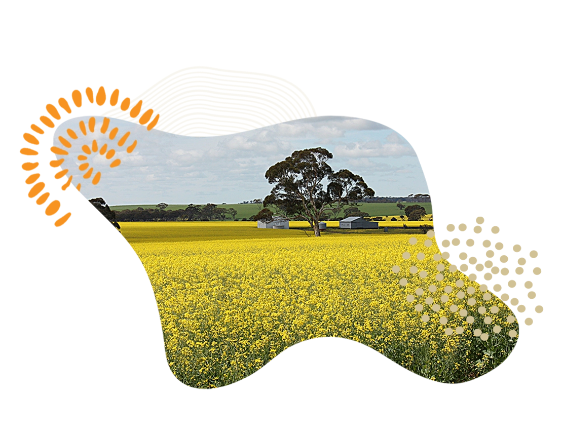
The Wheatbelt
The Wheatbelt covers an area of 154,862 square kilometres. The region surrounds the Perth metropolitan area, extending north from Perth to the Midwest region and east to the Goldfields-Esperance region and is bordered to the south by the South West and Great Southern regions and to the west by the Indian Ocean, Perth metropolitan area and Peel region.
It is home to three distinct Aboriginal groups – Njaki Njaki Nyoongar, Ballardong Nyoonger and Gubrun.
The region is popular with tourists thanks to its character townships, pioneering history, golden fields, rural farms and wildflowers. It is known for the world famous Wave Rock, which stretches 100 metres and stands 15 metres high, and the region’s Dryandra Woodland is one of Western Australia’s most important areas for wildlife preservation.
The Wheatbelt is Western Australia’s largest agricultural producer and is the source of nearly two-thirds of the State’s wheat production, half of its wool production, and the majority of its lamb and mutton, oranges, honey, cut flowers and a range of other agricultural and pastoral products.
Tourism and gold, nickel and iron ore mining also contribute to the region’s economy.
Population
The Wheatbelt population totals around 75, 000 people with a median age of 47 years and approximately 4.5% of the population comprises of those identifying as Aboriginal or Torres Strait Islander descent. (Source: Australian Bureau of Statistics Wheatbelt South, Wheatbelt North, Wheatbelt Development Commission).
Cost of living
According to the WA Council of Social Service, the cost of living in the Wheatbelt region is generally lower than Perth and other regional locations.
Climate
The Wheatbelt climate is characterised by high rainfall and mild temperatures near its coastal areas and hot, arid dry summers and mild winters in the eastern areas of the region.
In summer (December to February), the average daily maximum temperature is 34° C with daily minimum temperatures averaging around 17 ° C. In winter (June to August), the average daily maximum temperature is 17 ° C dropping to an average minimum of 5 ° C.
The average annual rainfall is 328mm, with most rainfall received between March and November.
Things to do
Sport and recreation
Sport and recreation play a vital role in communities across the Wheatbelt and are a large part of the social fabric that brings the region’s communities together.
Popular outdoor recreational activities include bushwalking, bird and wildflower watching, four-wheel driving, fishing, camping, and boating.
Other recreational pursuits such as arts and crafts, dance, music, theatre and performing arts are also well supported in the region.
The sporting community in the Wheatbelt is strong and diverse and the region has produced a number of talented athletes across a range of sports.
There are a number of clubs throughout the region, representing a range of recreational activities including hockey, football, cricket, netball, basketball, swimming, golf, athletics, lawn bowls, equestrian, horse racing, greyhound racing, pony clubs, cycling, rifle shooting, soccer, tennis, BMX and martial arts. Sport in the region is supported by the Wheatbelt Sportshouse, which provides support to sport and recreation organisations in the delivery of services to those living in the Wheatbelt.
For more information, visit:
Events and attractions
The Wheatbelt region hosts a number of events throughout the year, including farmer’s markets; agricultural field days and shows; film nights; musters; live music and theatre events; wildflower, music, arts, cultural, and food festivals; horse races; off road vehicle races; and bachelor and spinster balls.
The Wheatbelt is a region of rich pioneering history coupled with country charm where you can experience the character of outback pubs scattered across the region or experience farm life in the region with a local farm stay.
The region houses a number of natural attractions, the most famous being Wave Rock – an amazing rock formation that stretches 100 metres and stands 15 metres high in the shape of a giant wave about to crash over the surrounding bush. It is also home to a number of nature reserves and parks that can be easily accessed by vehicle and explored on foot.
The Dryandra Woodland is one of Western Australia’s most important areas for wildlife preservation and is home to numbats, tammar wallabies, brushtail possums, kangaroos and tawny frogmouth owls. Throughout June to early November, the region presents a dazzling display of Western Australian wildflowers, from carpets of everlastings to unique wreath flowers.
For more information on the region’s main events and attractions, visit:
- Regional Arts WA
- Explore Parks WA
- Wheatbelt Development Commission
- Australia’s Golden Outback
- Central Wheatbelt Visitors Centre
- Visitor Centres WA
Services and facilities
You will find a range of every day services and facilities throughout the Goldfields region, including banks, ATMs, libraries, business centres/telecentres, post offices, shopping (food, grocery and other), hardware stores, police stations, butchers, bakers, cafes, service stations, pubs/taverns, takeaways, newsagents, churches, pharmacies and restaurants.
For more information, visit the Tourist Information and Visitor Centre located in each town.
Schooling
The Goldfields region provides a range of government and non-government schooling options for primary, secondary and tertiary education.
In the public school sector, there are 54 government schools across the region, supported by a number of private schools.
For a comprehensive list of schools in the Goldfields, visit:
The region also provides higher education options through TAFE facilities. For more information, visit:
- Central Regional TAFE
- University of Western Australia, Rural Clinical School of WA, Narrogin
- University of Western Australia, Rural Clinical School of WA, Northam
Accommodation
The Wheatbelt offers a range of housing and rental options for those living in the region.
The median house price for the Wheatbelt region is $350,000 with the overall median weekly rental costing $485 per week (Source: REIWA Market Update; June 2025).
For more information, visit the REIWA website.
There is also a range of short-term accommodation options available throughout the Wheatbelt including caravan parks, camping grounds, backpackers, hotels, country pubs, motels, roadhouses, self-contained accommodation, bed and breakfasts, RV sites, and farm stays.
For more information, visit:
Health services
The Wheatbelt region covers four health districts – Coastal, Western, Southern and Eastern.
There is a network of public and private health providers servicing the Wheatbelt, who deliver a range of health services across the region including emergency response, primary health, mental health, population health and other ambulatory care services, residential and community aged care and inpatient acute services. Public health services in the region are well supported by private General Practitioners (GPs), government and not-for-profit agencies, allied health professionals and other private providers.
Aboriginal Health Services are integrated into existing public and private health services throughout the region.
”The people in the Wheatbelt are pretty down to earth, respectful of their GP, and generally lovely people. I find working with them and for them is a pleasure. The Wheatbelt itself can be hot, dry and dusty in summer but has its own beauty even then. Spring and winter months are amazing.
Dr. Bernard ChapmanMoora